
Planning applications
Manage application records, case stages, documents, correspondence and related workflow.
HorizoNext Planning
Manage planning applications, pre-apps, enforcement, appeals, documents, spatial checks and public-facing workflows through a browser-based development management system.
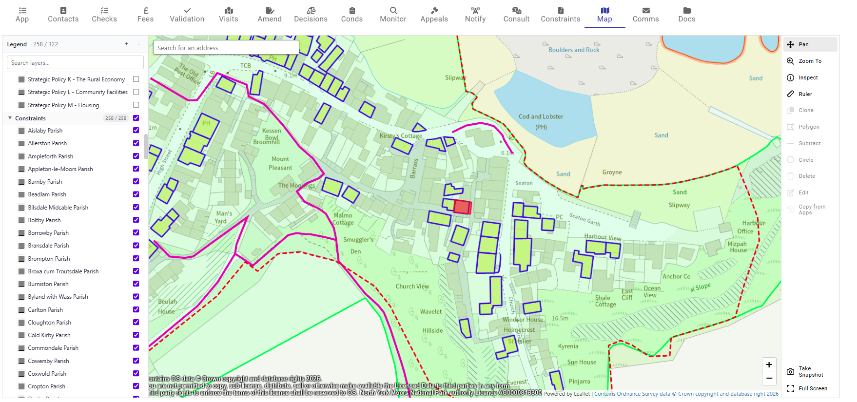
Development management work depends on applications, pre-apps, enforcement and appeals, but also on the council data around each case. Officers need access to documents and plans, addresses and property data, constraints, history checks, GIS boundaries, consultees, neighbour notification, public responses, reporting and integrations.
HorizoNext Planning brings those areas into a browser-based case-management environment so teams can manage the record, documents, map context and public workflow around each planning matter.
See how StatMap supported integrated Planning, Public Portal, Earthlight GIS and Local Land Charges workflows.
Manage application records, case stages, documents, correspondence and related workflow.
Support pre-application enquiries and associated documents, addresses and service steps.
Record complaints, notices, correspondence and related enforcement activity.
Manage appeal information against the relevant planning or enforcement record.
Support validation, registration, document indexing and early case setup.
Use templates for letters, notices, emails and other case correspondence where configured.
Use mapping tools to help capture and review site boundaries and spatial context.
Review relevant constraints, history and map-led information as part of case handling.
Use address and map context to support neighbour notification and consultation activity.
Connect public comments and consultee responses into the case process where implemented.
Use LLPG and AddressBase information where configured to support case creation and search.
Use reporting and operational views to understand case progress and team workload.
Planning teams need to understand where a proposal sits, what records relate to it and which documents form part of the case. HorizoNext Planning can use GIS to support site boundary capture, constraint checks, map-led neighbour selection and spatial review.
Addressing data can support property search, case creation and location context where LLPG or AddressBase data is configured. Documents, plans, correspondence and generated outputs can sit with the case record so officers have a clearer view of the information they are working with.
Where configured, planning application data and submitted documents can be imported into the case process. Public-facing services can also support application search, public access and responses where an authority implements those workflows.
HorizoNext Public Portal provides a route for public and consultee interaction around planning records, helping councils connect back-office case management with public-facing information.
Using Earthlight to turn configured map queries into Word reports for workflows such as contaminated land searches, planning screening and constraints reports.
Short public portal demonstrations for planning applications, appeals, property search, weekly lists and account creation.
Manage TPO records, correspondence and spatial information connected to planning work.
Maintain records for listed buildings and buildings of architectural or historic interest.
Capture and review sites, boundaries, status information and related planning metrics.
Planning is part of the HorizoNext case-management family, alongside Building Control, Local Land Charges and public portal options. The same platform approach can bring workflow, documents, GIS, addressing and reporting together around built-environment services.

Talk to StatMap if you are reviewing development management workflows, replacing a legacy planning system, improving GIS and document integration, or connecting planning with public portal services.