
Search request management
Record, track and manage search requests through a workflow-led process.
HorizoNext Land Charges
Manage Local Land Charges searches, registers, spatial checks and related workflows through a browser-based system connected to council GIS, addressing and case-management data.
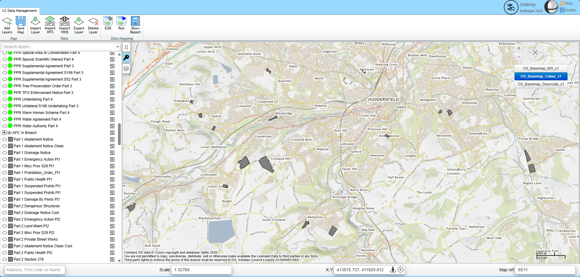
Local Land Charges work depends on more than a case list. Teams need reliable property and address data, GIS layers, search areas, registers, constraints, documents, reports and links to related council systems.
HorizoNext Land Charges brings those operational dependencies into a browser-based workflow so officers can manage search requests, review relevant spatial information and prepare outputs with clearer context.
See how StatMap supported integrated Planning, Public Portal, Earthlight GIS and Local Land Charges workflows.
Record, track and manage search requests through a workflow-led process.
Support the common search types and related checks that Land Charges teams manage day to day.
Provide a structured process for personal search activity and customer service handling.
Help teams manage register information and related updates alongside search work.
Use mapping and spatial layers to review search areas, constraints and relevant records.
Use address and property context, including LLPG and AddressBase data where configured.
Create documents and reports from templates, with scope for review before issue.
View workload, allocate tasks and understand progress across the team.
Connect to online and self-service routes where the authority chooses to provide them.
Land Charges searches often need spatial context. HorizoNext Land Charges can work with GIS layers, mapping data and property information so staff can review records, constraints and search areas in one place.
That context may include LLPG data, AddressBase data and configured layers such as flood information, conservation areas, historic buildings or other local datasets. The aim is practical: help officers check the right information and prepare clearer search responses.
For authorities using StatMap hosted mapping and spatial data services, Land Charges workflows can also sit alongside maintained OS mapping and related addressing services.
Local Land Charges can be stronger when it is connected to the service data that already exists elsewhere in the authority. Where configured, HorizoNext can help Land Charges teams use information from planning and building control alongside GIS and addressing data.
Planning applications, constraints and related spatial records can inform search handling when systems and data are connected.
Building control information can be part of the wider property record where an authority chooses to integrate it.
Councils may also need online services for customers, conveyancers or public users. HorizoNext can support public-facing and self-service options where they fit the authority's process.
These options can reduce manual handling for routine requests, improve customer access and help staff focus on review, checking and case progression.
Local Land Charges is part of the HorizoNext case-management family. That means it can share the same browser-based approach as other built-environment service areas, with workflow, documents, GIS and reporting brought together around the case record.
The module can be used as a focused Land Charges system, or considered as part of a wider review of planning, building control, public portals and spatial data across the authority.

Talk to StatMap if you are reviewing Local Land Charges workflows, replacing a legacy system, improving GIS integration or connecting search processes with wider council data.