
Browser-based case records
Manage service records through standard web browsers, with information organised around the case.
HorizoNext
Browser-based case management for local authority services, connecting applications, inspections, searches, documents, GIS, reporting and public-facing workflows.
Many local authority workflows depend on the relationship between cases, addresses, properties, boundaries and documents. Planning, building control and land charges teams need to manage applications, searches, inspections, consultations, correspondence and public-facing information in context.
HorizoNext provides a browser-based case-management approach for those place-based services, connecting records with GIS, documents, reporting and integration points where configured.
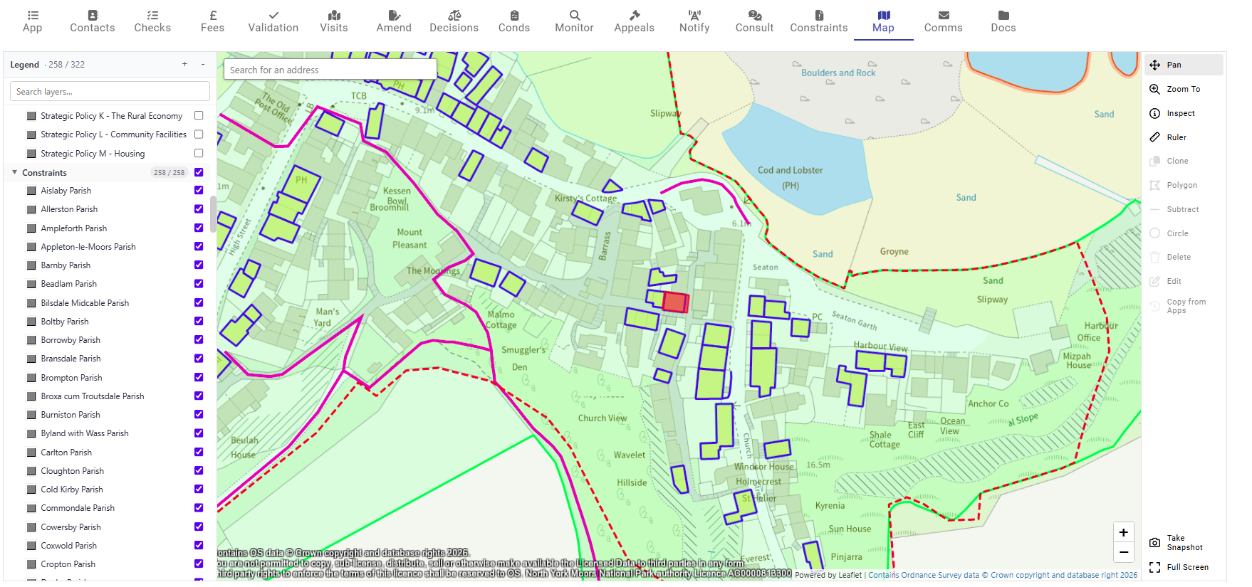
A HorizoNext case-management example connecting Planning, Public Portal, Earthlight GIS and Local Land Charges workflows.
Manage service records through standard web browsers, with information organised around the case.
Support configured processes, tasks and team responsibilities around local authority service delivery.
Keep documents, plans, letters, emails and templates connected to the relevant record.
Use maps, boundaries, constraints and location context to support case review.
Use address and property data to help locate records, create cases and understand service context.
Provide operational views that help teams understand workload, progress and service activity.
Connect back-office workflows to public search, comments, submissions and tracking where implemented.
Plan links with other systems, datasets, reporting tools and public-facing services where required.
Support officers working away from the office where mobile or cached workflows are configured.
Configure access so users see the records, functions and datasets relevant to their role.
HorizoNext can support a family of built-environment and related local authority service areas. The exact modules, integrations and public-facing workflows are configured around each authority's requirements.
Applications, pre-apps, enforcement, appeals, documents, GIS and public-facing workflows.
Applications, inspections, documents, consultations, mobile working and customer options.
Search workflows, registers, GIS-assisted checks, address data and public-facing options.
Public search, submissions, comments, responses and account-based interactions where configured.
Connect case-management workflows with GIS, gazetteers, reporting tools and other systems.
Migration, integration, GIS layers, address matching and reporting data around case workflows.
GIS can help officers understand the location and context of a case, including sites, constraints, addresses, neighbouring records and service boundaries. Documents and correspondence can sit alongside the case record, so users can work with plans, letters, emails and generated outputs in one place.
Reporting and dashboards can support workload visibility and service management. Integrations can be configured according to project needs, data sources and other systems involved.
HorizoNext Public Portal can extend case-management workflows into public-facing services. Depending on implementation, this can include application search, online submissions, comments, consultee responses, saved searches, account-based interactions and customer updates.
Case-management projects usually involve more than installing software. Data, workflow, documents, user roles, public access and integrations all need to be planned together.
Review and prepare legacy data, documents, addresses and spatial records for migration.
Help users, administrators and support teams understand the workflows they need to operate.
Plan the support arrangements around the software, data and service operation.
Provide a route for product questions, issues and implementation help.
Procurement and framework information changes over time. Contact StatMap or see our procurement information page for current routes.
Talk to StatMap if you are replacing a legacy case-management system, connecting workflows with GIS and documents, or extending public-facing services.