
Modern cloud-hosted services
A hosted service model to support modern access, delivery and system management.
Case study
Modernising Planning, Public Portal, Earthlight GIS and Local Land Charges workflows for North York Moors National Park Authority.

North York Moors National Park Authority partnered with StatMap to modernise its Planning and Local Land Charges operations, improving efficiency, accessibility and service delivery.
The project brought together Planning, Public Portal, Earthlight GIS and Local Land Charges functionality, helping the Authority move away from older systems and support more connected workflows across applications, spatial data, customer access and land charge searches.
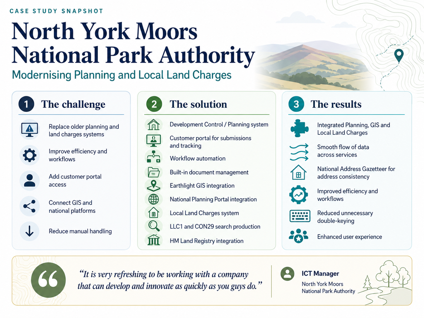
Case study snapshot showing the challenge, solution and results for North York Moors National Park Authority.
The Authority needed modern systems to replace older technology used to manage planning applications and Local Land Charges. The new approach needed to support more efficient case handling, provide a Local Land Charges service and improve the experience for customers using online services.
The project needed to support:
A hosted service model to support modern access, delivery and system management.
Clearer processes for handling planning and land charges work.
Spatial context connected to operational case and search workflows.
Integration with national platforms where configured for the service.
Portal functionality to support submissions, tracking and access to information.
Less duplication of effort across systems and processes.
StatMap provided a connected set of systems and services for the Authority, including:
A Development Control / Planning system to support planning application workflows.
Customer-facing portal functionality for submissions and application tracking.
Configured workflows to support more consistent processing and reduce avoidable manual steps.
Built-in document management and storage to keep case information, plans and correspondence connected.
Integration with Earthlight GIS so spatial information could support planning and land charges workflows.
Integration with the National Planning Portal to support planning application processing where configured.
Local Land Charges functionality to support LLC1 and CON29 search production and accessible land charge records.
Use of the National Address Gazetteer to support consistent address management across linked systems.
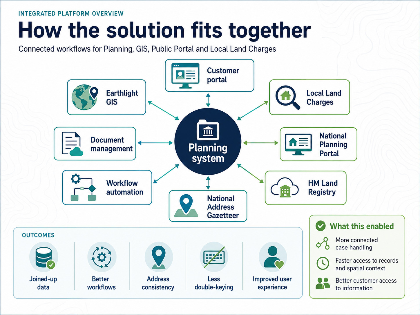
Integrated platform overview showing how Planning, Public Portal, Earthlight GIS, Local Land Charges and supporting workflow components fit together, with national integrations where configured.
The Local Land Charges element supported search production and access to land charge records, while connecting with the wider StatMap spatial platform.
The solution supported:
Browser-based planning workflows, documents, GIS, addressing and public portal options.
Land charges searches, registers, GIS-assisted spatial checks and related workflows.
Public-facing search, submission, comment and tracking options connected to back-office workflows.
Browser-based GIS and spatial data access for council teams.
Spatial data migration, address matching, integration and consolidation support.
Case-management platform for local authority service workflows.
Talk to StatMap if you are replacing legacy Planning or Local Land Charges systems, improving GIS integration, introducing public portal services or reducing manual data handling.