
Browser-based access
Give users access to configured products and workflows through standard web applications.
eVO Platform
The shared browser-based platform behind StatMap's GIS, gazetteer, case-management, public portal, workflow and spatial data services.
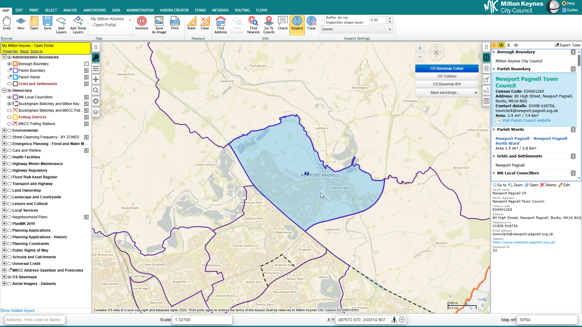
eVO is the shared platform approach behind StatMap's browser-based spatial software. It supports product areas that councils often need to connect: corporate GIS, gazetteer management, case management, public portals, workflows, reporting, integrations and spatial data services.
The value of a platform approach is practical. Council services depend on places, addresses, streets, boundaries, documents, cases and datasets. Those parts should not have to sit in isolated systems when a service needs them to work together.
Give users access to configured products and workflows through standard web applications.
Use maps, layers, boundaries and location searches to support service decisions.
Connect records, tasks and configured workflows with the places they relate to.
Keep documents, plans, letters and related outputs linked to the right service record where configured.
Use LLPG, LSG, UPRN and address-led data where licensed and configured for the authority.
Shape permissions and access around users, teams and operational responsibilities.
Present workload, spatial and operational information in reports or summary views where configured.
Support extracts, data movement and links with other systems according to project requirements.
Connect suitable workflows to public search, submissions, comments or status information where implemented.
Plan configuration, data migration, training and support under agreed arrangements.
Many local authority workflows start with a place: an address, property, application site, street, boundary, restriction, search area or map layer. eVO helps connect that spatial context with the operational records and documents teams need to manage.
This matters when authorities replace systems, consolidate platforms, reorganise services or improve data quality. GIS, case records, gazetteer data and public information are easier to manage when their relationships are understood from the start.
Not every customer needs every module. The eVO platform supports a family of products and services that can be planned according to project requirements, licensed modules and the authority's operating model.
Browser-based GIS and web mapping for internal users, spatial editing and service-specific applications.
Case-management workflows for planning, building control, land charges and related services.
Gazetteer management, addressing workflows and spatial review for local authority data teams.
Map-led TRO management, restriction editing, gazetteer support and public access options.
Public-facing search, submissions, comments and customer-facing workflows where configured.
Spatial data audit, migration, mapping data, address matching, geocoding and integration support.
eVO Flows can support repeatable processes and guided operational steps where configured, helping teams standardise tasks and reduce manual hand-offs.
Workflow support can be useful where users need a clearer route through data editing, quality checks, case-related tasks, review or approval steps. The right configuration depends on the service, data and users involved.
eVO services often need to exchange data with GIS layers, gazetteers, case-management modules, public portals, reporting tools and third-party systems. Data Services and integration work can support migration, transformation, extracts and data exchange where appropriate.
Plan and support spatial data audit, migration, address matching, geocoding, mapping data and platform consolidation.
Support ETL, synchronisation and data exchange between StatMap services and other systems.
Deployment should be agreed for the customer, project and service model. It may include hosting decisions, self-hosting requirements, data migration, configuration, training, integration support and ongoing support arrangements.
Current hosting, procurement and support commitments should be confirmed through the relevant reviewed service pages or directly with StatMap.
Plan support around agreed arrangements, product knowledge, data, configuration and service operation.
A route for customers to raise product questions, report issues and get help with configured services.
Knowledge transfer for users, administrators and service teams.
Practical advisory support around GIS, gazetteers, data migration, workflow review and integration planning.
Deployment options that should be reviewed against current project and service requirements.
Self-hosted deployment considerations that should be confirmed for the agreed environment.
Imported product summary for the eVO platform.
Imported architecture diagram for the eVO platform.
Imported eVO accessibility statement.
Talk to StatMap if you are reviewing GIS, case management, gazetteers, public portals, data services or workflows and want to understand how the eVO platform can support them.