
LLPG management
Manage local land and property records with the mapping, editing and review tools needed by gazetteer teams.
eVO GMS
Manage local address and street data through a browser-based gazetteer platform built for council workflows, spatial data quality and statutory service integration.
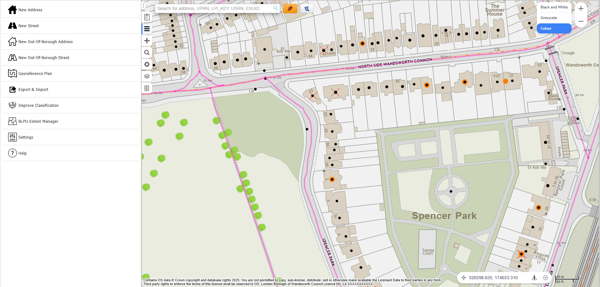
Local Land and Property Gazetteer (LLPG) and Local Street Gazetteer (LSG) data are operational foundations for many council services. They support planning, building control, local land charges, public portals, reporting, GIS, data migration and wider service integration.
When address, street and spatial data are trusted, teams can make better use of UPRNs, streets, property records, service boundaries and map-led workflows across the authority.
Manage local land and property records with the mapping, editing and review tools needed by gazetteer teams.
Support Local Street Gazetteer processes, including street records and associated street data.
Help custodians manage address changes, street naming and numbering links, and service requests around address data.
Use browser-based mapping to maintain provenances, review geometry and work with spatial context.
Prepare extracts, updates and change-only submissions for national gazetteer processes.
Use AddressBase and geocoding tools to help locate, check and connect address records.
Provide views, extracts and outputs that make gazetteer data easier to use in other services.
Connect gazetteer records with GIS, case management and downstream systems that rely on address data.
eVO GMS sits within StatMap's eVO and Earthlight spatial platform approach. It combines gazetteer records with browser-based mapping so users can review address and street data in spatial context.
The platform supports spatial editing, BLPU provenances, geometry maintenance, georeferencing of plans or drawings against mapping, and checks that help gazetteer teams understand where records sit on the ground.
Because the same platform can support GIS, gazetteer and case-management workflows, councils can reduce the gap between address data, maps and statutory service processes.
Gazetteer work depends on reliable base mapping and address data. StatMap can support councils with hosted Ordnance Survey mapping, AddressBase data and OGC services such as WMS, WMTS and WFS.
For some authorities this reduces the need to maintain large local copies of base mapping. For others it provides a clearer route for sharing trusted spatial data with internal systems, partner applications and public-facing services.
Why a unified LLPG and LSG should be ready from day one, and how eVO GMS can support legacy-system continuity and future transformation.
Short product demonstrations for GMS Shield record and batch-update workflows.
It truly is a 'create once, use many' solution that so many people in my position crave. I honestly wish I had moved to them [StatMap] years ago.
Product information for LLPG and LSG gazetteer management.
Existing customer views on eVO GMS and StatMap.
Information about Street Naming and Numbering support around eVO GMS.
Talk to StatMap if you are replacing a legacy GMS, improving LLPG/LSG workflows, consolidating data or planning wider spatial data integration.