
From map query to Word report: modern spatial reporting in Earthlight
How Earthlight can help councils generate map-inclusive Word reports from spatial queries, supporting workflows such as contaminated land searches, planning screening, constraints reports and property information packs.
Many council GIS workflows follow a familiar pattern.
An officer defines a site or search area, checks the relevant GIS layers, then produces a structured report for review, sign-off or sharing with colleagues. The report might support a planning application, a contaminated land enquiry, an environmental search, a constraints review, a land or property question, or an internal officer assessment.
For many authorities, that pattern has historically been associated with MapEagle-style reporting: select an area, query council GIS layers, and generate a Microsoft Word report. The workflow is familiar, the templates are embedded in day-to-day practice, and officers often rely on the output format as much as the underlying map query.
Earthlight now supports that style of spatial reporting directly within StatMap's browser-based GIS platform.
The aim is not simply to replace one named tool with another. The more important point is that councils can modernise a familiar reporting workflow while keeping the essential pattern officers already understand: define the site, query spatial data, generate a structured Word report, and review the result.
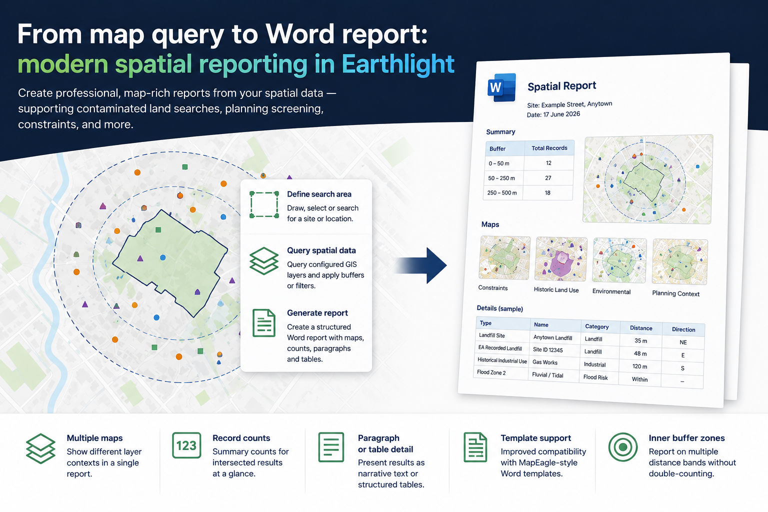
Earthlight spatial reporting turns a configured map query into a structured Word report with maps, counts and detailed results.
Why this matters now
ArcGIS Desktop and ArcMap retired on 1 March 2026, with Esri ending support for ArcGIS Desktop and ArcMap from that date. That has prompted many councils to review workflows that still depend on older desktop GIS tooling, including reporting processes built around ArcMap-era integrations.
The risk is not only technical. These workflows often sit inside planning, environmental, land and property teams. They may have established templates, agreed report wording, known GIS layers and officer expectations built around them.
Replacing them successfully means respecting the familiar workflow while moving the technology forward.
Earthlight's spatial reporting capability provides a practical route: keep the select-query-report model, but run it from a modern web GIS environment.
What Earthlight already supported
This is not a separate product bolted onto Earthlight.
Earthlight already supported Word document generation from spatial queries. Users could query GIS layers and produce reports containing selected or intersected records. That foundation is central to any spatial reporting workflow: the map defines the area of interest, the configured layers provide the data, and the report brings the results together in a usable format.
The latest work extends that existing capability so that Earthlight can support more sophisticated MapEagle-style reporting patterns.
What has been added
The enhanced reporting capability adds several features that matter for real council report production.
Multiple maps in one report
A single generated Word document can now include several map views for the same location. Each map can show a different layer context or theme.
For example, a contaminated land search might need one map showing the site, another showing historical or potentially contaminative land-use layers, another showing flood risk or environmental constraints, and another showing planning context.
Keeping these maps in one report avoids the need to manually assemble multiple screenshots or produce separate documents.
Record counts
Reports can include summary counts from spatial query results.
For example, an executive summary might state that a defined number of landfill, planning, flood-risk or environmental records intersect the search area. This gives officers a quick view of what the query returned before reading the detailed results.
Detail as paragraphs
Some reports need narrative output rather than raw tables.
Earthlight can present detailed records as paragraphs, which is useful where officers need readable prose for planning, environmental or screening reports.
Detail as tables
Other reports need an auditable list.
Earthlight can present detailed records as tables, with one row per record, making it easier to review, cross-reference and share results.
Improved template support
Councils often have established Word templates that officers and customers recognise. Improved template support helps councils move reporting into Earthlight without asking teams to redesign the entire output from scratch.
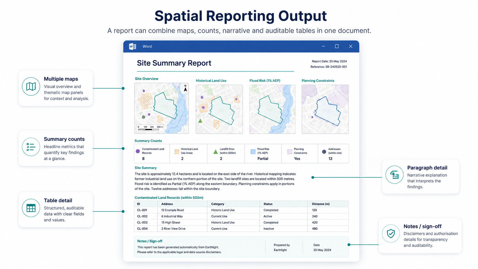
A spatial report can combine maps, summary counts, narrative detail and auditable tables in one document.
Inner buffer zones
Some reporting scenarios need more than a single distance search.
Earthlight can support inner-buffer logic so that a report can distinguish between features close to the site and features in a wider surrounding band. For example, a report might return records within 0-50 metres, then separately return records from 50-250 metres without double-counting features that appeared in the first band.
That is especially useful for environmental, contaminated land, planning and constraints searches where proximity matters.
Example: contaminated land search
Contaminated land is a good example of why this matters, but it is not the only use case.
Government planning guidance recognises land contamination as something that can often be dealt with through the planning system, while contaminated land statutory guidance also places responsibility on local authorities for determining contaminated land under Part 2A. In practice, councils may need to consider records, constraints, historical land uses and spatial relationships when supporting planning or environmental workflows.
In Earthlight, a contaminated land-style report could follow a familiar process:
- Define the site or search area.
- Query configured GIS layers, such as historical land-use records, landfill records, flood-risk layers, ecological designations, planning constraints or other locally maintained datasets.
- Apply appropriate buffers or distance bands where needed.
- Generate a Word report containing maps, counts, paragraphs and tables.
- Review the report in Word, then save, edit, print or export to PDF as required.
The important phrase here is "configured GIS layers".
Earthlight provides the reporting engine: the mechanism for querying spatial data and assembling a structured Word document. It does not decide what datasets exist, how local layers should be configured, or how the results should be professionally interpreted.
That remains a council responsibility. The quality of the report depends on the quality, currency and configuration of the data being queried.
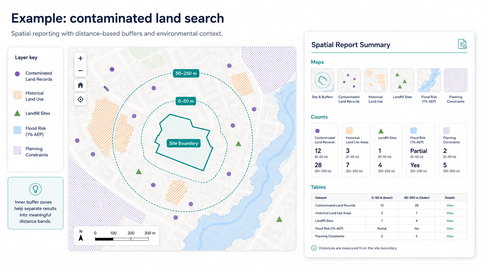
Example contaminated land-style search using site boundaries, distance bands, configured GIS layers and report summaries.
Other workflows this can support
Although contaminated land searches are a useful example, the same reporting pattern can support many council workflows.
Planning application screening
Officers can check incoming applications against relevant GIS layers and produce a report showing constraints, designations or contextual information that may need consideration.
Environmental searches
Environmental teams can generate reports from configured layers such as flood risk, ecological constraints, historic land-use records or other locally maintained environmental datasets.
Constraints reports
A constraints report can summarise what spatial features intersect a proposed site, supporting land referencing, development screening, internal review or early feasibility work.
Land and property reports
Property, estates or land information teams can produce map-inclusive reports tied to parcels, addresses or other defined search areas.
Internal officer reports
Teams can use consistent Word templates to generate reports from live GIS data rather than manually copying map images and query results into documents.
Customer-facing information packs
Where appropriate, councils can produce more polished, map-inclusive packs for applicants, developers, colleagues or the public.
A familiar workflow, modernised
The end-to-end process is intentionally familiar:
Define the site
Set the viewport or draw the search area in Earthlight.Run spatial queries
Query the relevant council GIS layers.Generate the Word report
Produce a structured DocX report containing maps, counts, paragraphs and tables.Review and distribute
Open the document in Word, then save, edit, print or export to PDF as required.
This approach means councils can modernise the technology behind the workflow without forcing every team to change the way they think about spatial reporting.
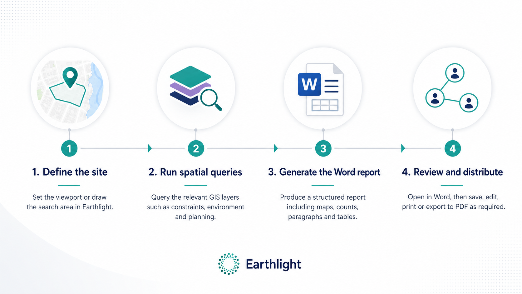
A familiar workflow: define the site, run spatial queries, generate the Word report, then review and distribute.
What councils should review before migrating
Moving a reporting workflow into Earthlight is not just a technical conversion exercise. Councils should review:
- which report templates are still needed
- which GIS layers feed each report
- whether layer names, attributes and styling are still fit for purpose
- what buffers or distance bands are required
- which outputs should be paragraphs, tables, counts or maps
- who is responsible for data quality and sign-off
- whether the report is internal, customer-facing or both
- how generated documents should be stored, edited and shared
A well-structured template is only useful if the underlying data and governance are sound.
Why Earthlight is a good fit
Earthlight is already a browser-based GIS platform used to present, query, edit and work with council spatial data. Adding richer Word reporting brings that spatial context into a format officers already know how to review, annotate and distribute.
For councils that have relied on MapEagle-style reporting, the benefit is not simply that a report can be generated. It is that the familiar reporting pattern can now sit inside a modern GIS platform, with richer outputs and less dependency on legacy desktop tooling.
Talk to StatMap
If your authority still depends on MapEagle-style reports, contaminated land search templates or other GIS-driven Word reports, StatMap can help you review how those workflows could be supported in Earthlight.
We can look at your existing templates, GIS layers and reporting requirements, then help identify a practical route from legacy reporting to modern web-based spatial reporting.
Watch the reporting walkthroughs
These short videos show the DocX reporting workflow in Earthlight, including template handling, selecting records by layer, and adding multiple map layers to a generated Word report.
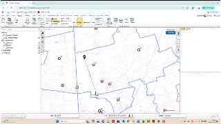 Spatial Reporting / DocX Reports
Earthlight: DocX Templates
A spatial reporting walkthrough covering how Earthlight uses DocX templates for configured Word report outputs.
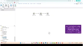 Spatial Reporting / DocX Reports
Earthlight: DocX Select By Layer
A report-generation demonstration showing how Earthlight selects records by layer for DocX output.
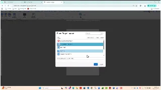 Spatial Reporting / DocX Reports
Earthlight: DocX Multiple Map Layers
A DocX reporting walkthrough showing multiple Earthlight map layers in a generated Word report.
Discuss Earthlight spatial reporting
Talk to StatMap about contaminated land searches, planning screening, constraints reports or MapEagle-style Word reporting inside Earthlight.